
Ground rover
Four-wheel-drive chassis sized for soft soils and low vegetation, with on-board drivetrain and power management.
Lab-tested
Robotics and artificial intelligence in the service of demining.
A ground rover and its radar designed in Senegal, complemented by a support drone and a predictive model, to detect before a human life is exposed.
Representing an institution or a competent authority? Read the operating framework
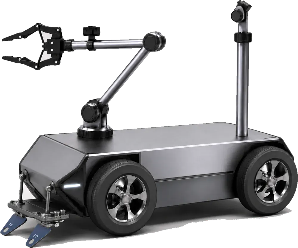
Autonomous ground rover Lab-tested
Moves across the area on its own and probes the ground, with no personnel exposed.
Support drone Acquired
Surveys the area from the air and relays the radio link.
Predictive AI In design
Prioritises the surfaces to be probed and produces a risk map.
Designed and developed by a multidisciplinary Senegalese engineering team.
01 - The system
Each block carries an explicit validation status. Anything not yet tested is flagged as such.
Four-wheel-drive chassis sized for soft soils and low vegetation, with on-board drivetrain and power management.
Off-the-shelf aircraft, selected for prior aerial survey of the area, photogrammetric mapping and radio relay to the operator station.
Transmit/receive antennas designed locally, electronics finalised on a printed circuit board and integrated into the rover. First detection trials completed.
Decision-support model combining past detections and terrain data to prioritise the surfaces to be probed.
ROS 2 autonomous navigation and operator interface: real-time monitoring, immediate manual override, emergency stop.
02 - Concept of operation
The drone surveys, the rover probes, the operator decides. Nobody walks on the area until it has been characterised.
The area and framework are set by the competent authority.
Drone overflight and mapping of the area.
A path covering the entire surface.
Autonomous progression and continuous ground probing.
Geo-referencing of anomalies and immediate avoidance.
Data delivered to the authority and the operator.
The rover returns to its entry point and the mission closes.
03 - Institutional framework
Diambar SAFER is a support tool. It does not conduct demining operations, does not replace any accredited operator, and only intervenes at the request and under the control of the competent authority.
Defines the area, authorises the intervention and sets the mission framework.
Runs the mission, supervises the system and validates every operational decision.
Acquires, measures, maps. No irreversible action, no autonomous decision.
Geo-referenced data returned to the authority, which retains ownership and use.
↻ The loop closes on the authority: the system produces information, not decisions.
04 - Operating doctrine
These principles are design constraints, built into the system architecture rather than added on top.
Every mission is continuously supervised. The operator retains manual override and emergency stop at all times. Autonomy covers movement and acquisition, never decision-making.
The system detects, locates and maps. It never acts on explosive ordnance. Handling detected objects is the exclusive remit of certified teams.
Results are indications to be confirmed through established procedures. No area is declared safe on the basis of a system acquisition alone.
The system is designed to fit within the International Mine Action Standards (IMAS / NILAM) and national procedures. No compliance is claimed prior to formal assessment.
Detection and mapping data produced by the system constitutes sensitive information infrastructure. It is owned by the requesting national authority, hosted on infrastructure it controls, and is never transferred to any third party without its written consent. No coordinates of suspected areas are published on this site.
05 - Transparency
The project has moved from a paper dossier to a rolling prototype. This page is updated at every milestone, including when a milestone is missed.
No detection performance has been measured under operational conditions to date.
06 - Public presence
The prototype has been shown publicly and before juries since 2025. Every appearance is dated and verifiable.
Dakar
Second entry, with a rolling prototype presented to the jury after an initial paper application.
Dakar
Presentation of the project to national investors.
Dakar
First edition. The project was then at design-dossier stage.
07 - The team
Engineering and management students in electrical, mechanical and computer engineering. Every building block of the system has a named owner.
Project lead - ROS supervision and integration
Coordination - management and finance
Instrumentation and GPR design
Power systems and ROS simulation
Instrumentation - ROS perception and localisation
Artificial intelligence and data analysis
Control systems and autonomous driving
Mechanical design
Mechanical manufacturing
Mechanical manufacturing
08 - Supporters
The prototype exists thanks to institutional support, academic supervision and the team’s own financial commitment.
Funding
Financial support for prototype development.
Funding and scientific guidance
Financial support, academic supervision and access to workshops and test facilities.
Project members’ contribution
Own funding committed by the team since inception.
09 - Get in touch
Each request is routed to the relevant contact. Institutional enquiries are handled directly by the project management.
Government services, national mine action bodies, defence and security forces: requests for information, demonstration or project oversight.
Write to the project lead→ cheikhtidianediop2@esp.snDonors, cooperation agencies and foundations wishing to review the project file, governance and maturity trajectory.
Request the project file diambarsafer@gmail.comCollaboration on ground-penetrating radar, autonomous navigation, signal processing or the trial campaign.
Propose a collaboration diambarsafer@gmail.com